Through the middle of the Lake District there is a Roman road, which once linked Ambleside Roman fort with Brougham fort near Penrith. It ran for about 20 km over the high fells with the highest point at 828m, named High Street after the road it sits on. Some bits are indistinct, and the exact route is possibly not as well defined as you might think. For a start it is around 2000 years old, although possibly older. Excavations have shown that the construction isn’t typically Roman, and the parts actually linking the forts are particularly vague. There is a theory that the route followed an older pack horse trail. It’s first mentioned in land charters from around the twelfth century, although then called Bredestrete. The current course, and hence the scheduled ancient monument, was largely taken from Ordnance Survey mapping from the 1970s, before a surge in the popularity of hiking had started all the wear and tear we see all over the hills today.
There was no better day for CYHA to add to that wear and tear than Easter Sunday 2025. After a cold spring that never seemed to end, we finally had a day of summery weather. Sunshine and blue skies were the theme of the day. As for views, we could see Cross Fell in the north Pennines, Ingleborough in the Yorkshire Dales, Scafell and Scafell Pike in the Lakes.
The walk started with a path diversion due to the winter storms knocking out the foot bridge immediately downstream of Hayeswater reservoir. We spent the best part of an hour negotiating the tussocky hillside of the path diversion only to find when we got to the broken bridge crossing, we could probably have hopped across the stream.
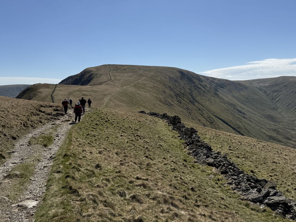
From here we started to climb, pausing for a wee breather about halfway up to our first summit of the day, The Knott. Although The Knott was technically optional, the whole party decided to summit and enjoy the view. That view included a sightline all the way to the summit of High Street, including the distinctive green band of the old Roman Road just below the summit ridge.
We paused for second lunch leaning against a handy stone wall. Here we girded our loins for the main ascent up the Straits of Riggindale. There was something of a chilly breeze to offset the sunny weather as we passed the head of Riggindale valley (more fabulous views) before hitting the trig point at 828 m in the middle of what is known as Racecourse Hill. Third lunch.
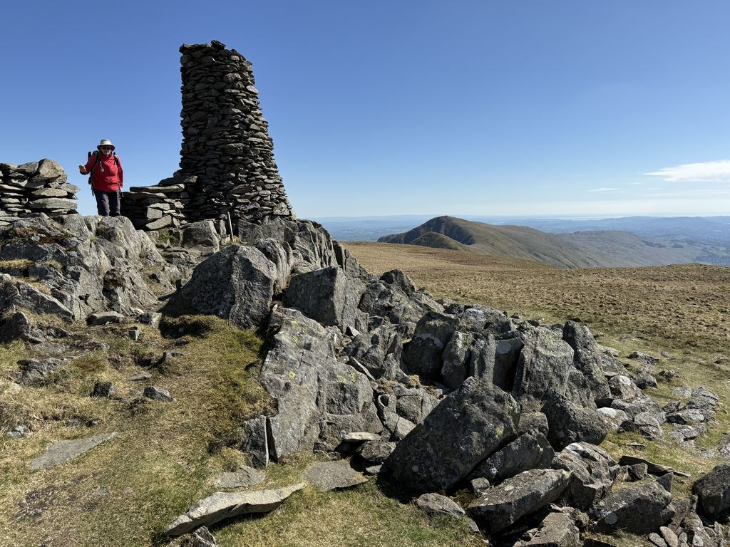
Fourth lunch was a relatively short distance away in the shadow of the massive cairn on Thornthwaite Crag. For Dave and Ali this was the second ascent of Thornthwaite in a week as it formed part of the Kentmere horseshoe (Wainwrights 210, 211, 212 and 213 climbed the previous Sunday). In a testament to the heat of the day, we met a French fell runner who’d run out of water. From here it was a slightly horrible gravelly descent down to Threshthwaite Mouth (Fifth lunch) and our return to civilisation via Pasture Beck. In this case civilisation was defined as the Brothers Water Inn. Many thanks to George and Colin for taking pity on the footsore and giving some of us a lift back to the centre.
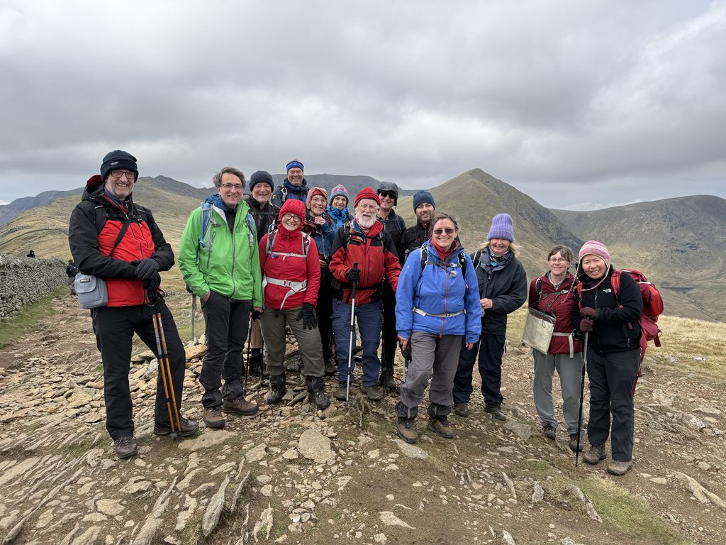 I can’t sign off without giving thanks to everyone who joined me on my last Wainwright (Birkhouse Moor, no. 214 out of 214) on the Saturday before Easter. I managed to haul the bottle of prosecco all the way up there, but it was unlikely to intoxicate when shared between 15 people!
However, four of the group did have sufficient Dutch courage to join the crowds on a death-defying scramble up Striding Edge to the summit of Helvellyn.
Ali